


🚧 PARKING LOT CLOSURE NOTICE 🚧🇺🇸🚗
Heads up, everyone! The Jackson Flat Reservoir parking lot will be closed beginning Thursday (7/23/26) evening through Sunday (7/26/26) for the 24th of July festivities and the Kane County Car Show.
🚫 There will be NO access to the boat dock during this time. The parking lot will be blocked off, and vehicles will not be allowed through.
If you’re planning to spend time at the reservoir this weekend, please plan ahead and make other arrangements.
We appreciate your patience as our community celebrates an exciting holiday weekend. Have a safe and happy 24th of July! 🇺🇸🎆
Jackson Flat Reservoir is an ever improving place for recreational activities of all kinds. Whether you like to boat, fish, camp, bike, hike, or work out, it has something to offer. For questions on the reservoir or amenities, and pavilion reservations please feel free to contact the KCWCD office.
To keep it a safe and fun place for everyone, we do ask that you adhere to the following guidelines (subject to change):
- Boating: ONLY electric trolling motors allowed
- Boaters follow the rules/regulations pertaining to Quagga Mussel
- Don’t “Ditch a Fish“: all Utah State Fishing Regulations apply
- Pick up after yourself and your pets (city ordinance 13-200.01.130)
- Pets must be on a leash at all times (city ordinance 13-200.01.070)
- Discharge of fireworks is prohibited (city ordinance 6-1-21-O)
- No Camping or Overnight Parking at the Pavillion/Boat Ramp
- No motorized vehicles on Sherry Belle Trail (e-bikes okay)
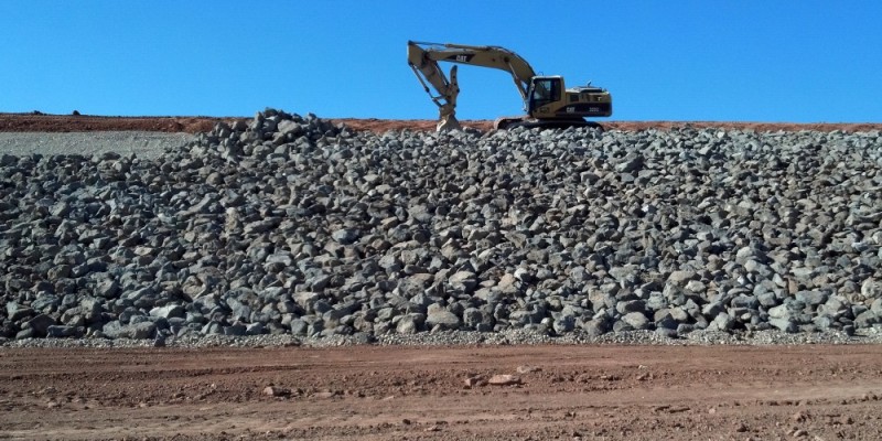
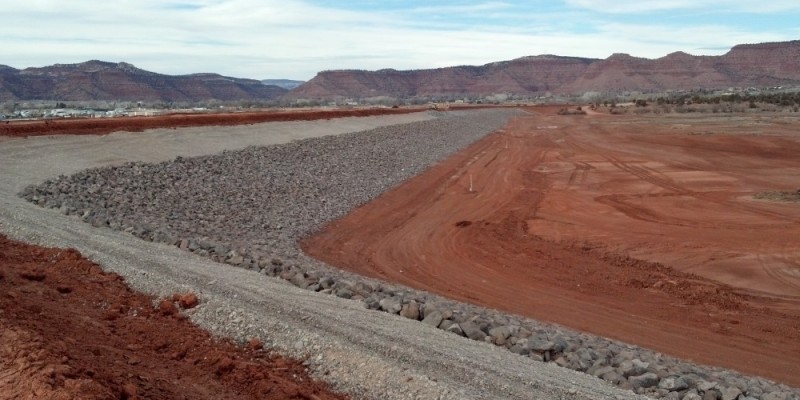
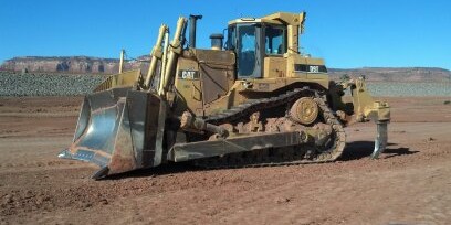
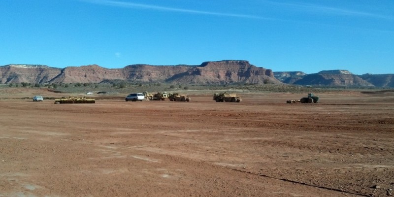
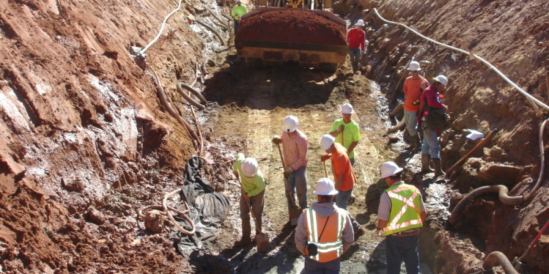
After 15 years of planning, and 19 months of construction, head-gates to fill the Jackson Flat Reservoir were opened in spring 2012. The Dam structure is composed of 800,000 yards of carefully sampled and tested clay, dirt, and rock. The project was supervised by four engineering firms including the Utah State Engineer of Dam Safety, and the Army Corps of Engineers. The 4,228 acre-feet reservoir is an off stream site fed by a 24 inch pipe capable of flowing just shy of 24 acre feet per day. The average depth of the reservoir is 28 feet with a conservation pool that will sustain a 400 acre-foot pool of water. This additional secondary water source could also be used to meet other outdoor public needs such as the golf course, parks, and schools.
KCWCD has connected lines, drilled wells and built storage facilities to improve irrigation capacity within Kane County. A 450 gallon per minute well was drilled into the Alluvium aquifer north of Kanab to increase the water supply in the summer as well as provide added pressures in the upper zones of Kanab’s irrigation system.
In 2011, the District replaced 8 miles of 50 year old cast iron pipe with a 24-inch PVC pipeline to supply Kanab City. The project also included a line extension to the Ranchos subdivision south of Kanab to increase flow & capacity.
Below is a chart demonstrating the fill level at the Jackson Flat Reservoir from month to month. The water level is measured on a weekly basis. The chart shows a figure for each month which is an average of the fill levels for that month.
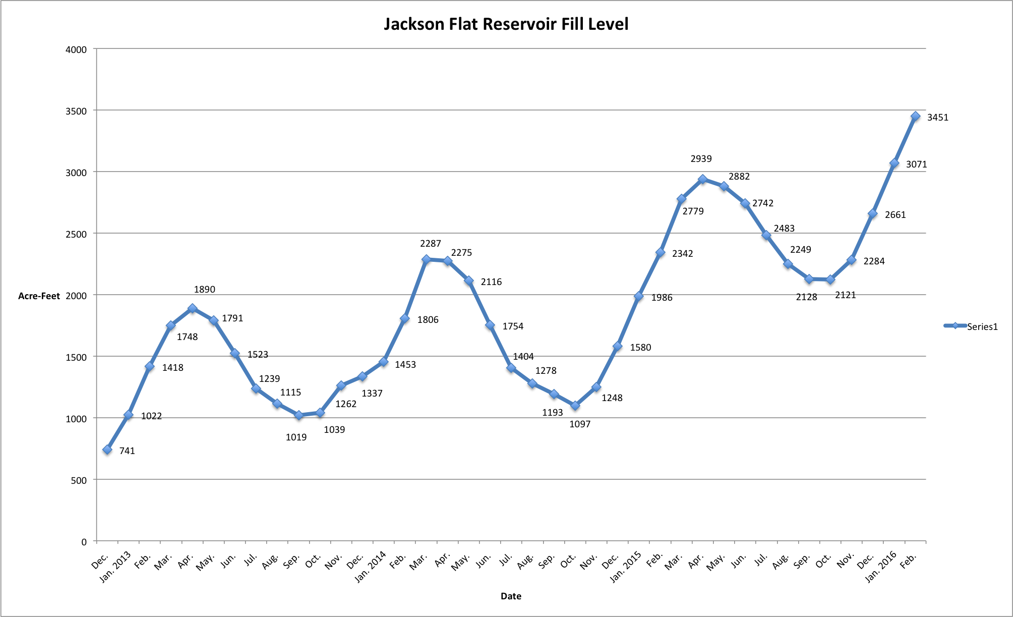
click on the image for a larger view of the chart.